

Gravimeter app for iPhone and iPad
Developer: 健 李
First release : 28 Sep 2014
App size: 18.51 Mb
This is the most green gravity and location record tool in the App Store.
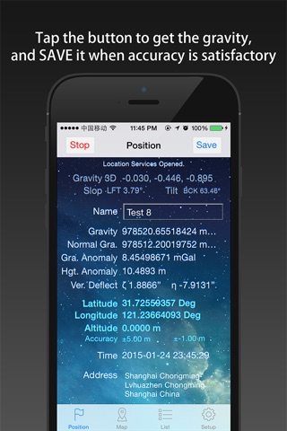
This App is very easy to be used recording the location. In the process of marching, you can record the current position of gravity, longitude, latitude, altitude, address, and photos. All of data can be derived, including photos, and can be opened in the post-processing software such as Google Earth.
The coordinate and gravity information are under the WGS84 coordinate system, including the normal gravity, gravity anomaly, height anomaly and vertical deflection, etc., are CALCULATED adopt the global gravity field model (EGM96, WGS84). The location’s accuracy depends on the phone acquisition and positioning environment.
All of the information are for reference only.
[capabilities]
1. The use of mobile phone GPS sensors, acquire and save the current position of longitude, latitude, altitude and address information.
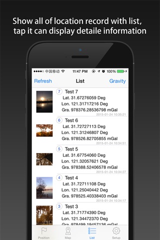
2. Support edit the saved record, you can add multi photos for each record.
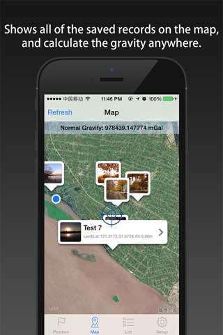
3. Display the saved record on the map.
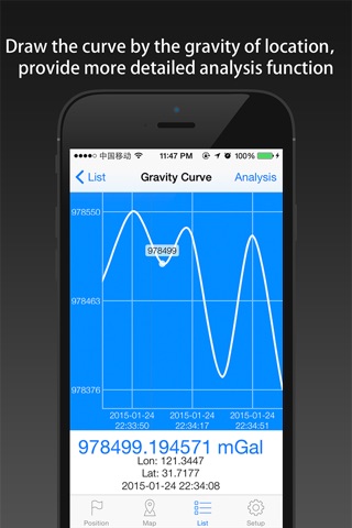
4. Statistics all the gravity change information, and draw them in a chart.
5. No IPA, no background refresh, no ADS.
[save electricity design]
1. Dont record track, only record the location of the interesting point.
2. The positioning function whether open is completely determined by the user, provide switch button for operation, and use it every time you open the can.
3. The software automatically shut down into the background positioning function, shut down the background refresh function.
4. In both positioning function and display on the map function, optimization software made possible, make the minimum power consumption and the network flow.
5. Only in case of necessity, guiding users to use network traffic (on the left an anchor point too far, or unable to get WIFI around fingerprint).
[data export]
1. CVS format file can be exported.
2. KML format file can be exported, which can be opened by Google Earth software.
3. Can export all photos of the records.